





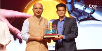












To build a unified spatial data framework for a developed India, the focus should be on adopting a federated architecture that enables data to remain with the respective custodians while being seamlessly discoverable and accessible through standardized APIs and Data as a Service (DaaS). In an exclusive conversation, Agendra Kumar, Managing Director, Esri India recommends to Rajneesh De, Group Editor, APAC Media & CXO Media that the ‘system of systems’ approach could ensure that authoritative geospatial data from different ministries, departments, and organizations are securely shared and integrated without the need for centralized data repositories.
Could you briefly introduce Esri India and your role in driving its growth and innovation? Also, what are the key pillars of the company’s go-to-market (GTM) strategy?
Esri India is the leading provider of GIS and Location Analytics solutions to governments, public and private sectors, NGOs and academia. Incorporated in 1996, we now serve approximately 6,500 organisations in India, with an estimated 1.5 million individual users using ArcGIS within those organisations. We currently have about 800 people and 10 offices across the country. Esri India’s innovations are currently focused in three areas –Geospatial content, GeoAI and Living Digital Twins.
We introduced Indo ArcGIS several years ago to address critical gaps in geospatial data availability and to provide ready-to-use solutions for common user applications. We then established a platform called ‘Indo ArcGIS Living Atlas’, which provides India-specific open data layers hosted on a cloud within the country and helps to deliver outcomes suited to Indian government and enterprise contexts. More recently, we launched offline Indo ArcGIS raster and vector base maps. These have given a cost effective and easy alternative for high quality basemaps to the GIS community in India; we have seen good adoption.
Coming to AI, we have a GeoAI-first innovation agenda, anchored by a dedicated GIS & AI Competency Centre in Noida, where Esri India announced in July 2025, an investment of ₹150 crore over the next 3-5 years. This centre has already helped a couple of hundred users in adopting AI based analytics in their GIS application workflows. This centre also has a knowledge-sharing agenda, with experts conducting workshops and seminars to help users in capacity building.
Digital twins are increasingly being adopted across industries due to their ability to simulate real-world scenarios, optimize operations, and support data-driven decision-making. ArcGIS serves as a foundational platform for living digital twins. Our innovative digital twin solutions integrate GIS, BIM, Artificial Intelligence, and real-time data to deliver a comprehensive digital view of the built environment.
Government, both at the Centre and across the states, continues to be our largest customer segment. To cite some examples, user organizations include national mapping agencies like the Survey of India, Geological Survey of India, National Thematic Mapping Organisation, NIC, the Registrar General of India; ministries like MoHUA, Jal Shakti, MoRTH, DOLR at the centre and ULBs, forest, water resources, disaster management at the state level. On infrastructure side, airports, railways, construction companies, and utilities—electricity, gas, telecommunications, and water—form another major segment.
Private sector adoption has accelerated since policy reforms between 2021 and 2023 clarified access to geospatial data. Retail, quick commerce, manufacturing, and insurance companies are now using GIS enthusiastically. Though smaller than the government in scale, this market is growing rapidly.
Education has also been a strategic priority for Esri India. We are committed to equipping students, researchers, and educators with geospatial knowledge and skills that prepare them to solve real-world challenges. By working closely with universities, academic institutions, and educators, we are helping nurture the next generation of geospatial professionals who will drive innovation across industries.
Additionally, our engagement with NGOs helps them make informed decisions, optimize resources, and maximize the effectiveness of their initiatives. ArcGIS helps NGOs improve their work by connecting data to maps. It lets teams see where help is needed, use resources well, and show their impact.
As Indian cities become more complex, what role will GIS-enabled digital twins play in transforming urban planning and infrastructure development?
As urbanisation accelerates across India, with nearly 40% of our population expected to live in cities by 2030, traditional, static planning approaches simply aren’t equipped to handle the complexity involved. This is where GIS-enabled Living Digital Twins come in. These are continuously updated, dynamic virtual models of physical assets, systems, or environments. They integrate real-time data streams from IoT sensors, AI, and GIS to reflect real-world operational changes as they happen.
Unlike static 3D city models, a Living Digital Twin mirrors real-world urban conditions in near real time. It lets city administrators simulate ‘what-if’ scenarios for mobility, utilities and development plans before implementing anything in the real world.
ArcGIS serves as a foundational platform for living digital twins by merging reality capture, BIM models, and IoT sensor feeds. It drives end-to-end workflows from data collection to real-time spatial analysis.
It integrates disparate datasets and enterprise systems into a single source of truth across a project’s entire lifecycle, strengthening data capture, enabling immersive real-time visualisation and supporting AI-driven forecasting. By combining GIS, real-time data, AI and digital twin technology, our cities can move from reactive management to predictive, intelligent urban operations, building futures that are more sustainable, resilient, and citizen centric.
As GeoAI becomes central to enterprise and public sector innovation, how is Esri India helping develop the talent and ecosystem needed to accelerate adoption in India?
We are working with about 1000 colleges and universities across the country to build a strong geospatial workforce for India. Our partnerships with universities through MoUs reflect our long-term commitment to strengthening India’s geospatial ecosystem. GeoAI is one of the most transformative innovations shaping the future of geospatial technology. Most recently, we signed an MoU with Delhi Technological University to establish a dedicated Centre of Excellence in GeoAI to build capabilities, promote applied research, and develop the next generation of geospatial and AI professionals.
To ensure that students remain abreast of rapidly evolving technologies, it is essential to continuously strengthen geospatial education at the college and university levels. Academic curricula need to evolve in line with industry requirements, and faculty members must be equipped with the latest knowledge and skills to effectively train the next generation of geospatial professionals. Recognizing this need, we established the GIS Academia Council of India (GACI), a unique platform that brings together leaders from academia and industry to collaboratively shape geospatial education. GACI focuses on aligning academic programmes with evolving industry needs, enhancing faculty capabilities, and preparing students to be job-ready with the skills and practical knowledge needed to solve real-world challenges and create meaningful impact.
By adopting the GACI recommendations on what to teach, how to teach, who to involve, and why it matters for national growth, the academic institutions have an opportunity to create a truly integrated geospatial ecosystem—one in which academia produces graduates with the knowledge, adaptability, and practical experience to contribute meaningfully.
We also conduct faculty development programmes in collaboration with institutions like IIT Tirupati and IIT Roorkee to build GIS and GeoAI teaching capabilities, empower educators with the latest geospatial technologies, and enable them to integrate those into academic curricula across disciplines.
Beyond Digital Public Infrastructure, does India now need to think of geospatial infrastructure as a national strategic asset? What changes are required to build a unified spatial data framework for a developed India?
Yes, having a national geospatial infrastructure (NGI) will be the key to place India among the leading countries in terms of the adoption of geospatial technologies.
Digital Public Infrastructure focused on ‘who’ and ‘what’, and achieved considerable success in its objectives, but the ‘where’ dimension remained unaddressed. Integrating geospatial intelligence adds this critical ‘where’ dimension to digital data, providing context for smarter decision-making, more efficient service delivery, and greater national resilience.
GIS is today regarded as a ‘system of systems’—a unifying platform that integrates data, applications, business processes, and technologies across an organization. Rather than operating in isolation, GIS connects enterprise systems such as ERP, CRM, IoT, BIM, remote sensing, AI, and digital twins through the common language of location, creating a comprehensive view of assets, operations, and the environment.
A National Geospatial Infrastructure will extend this vision to the national level by serving as the geospatial backbone that connects diverse datasets, institutions, and digital platforms. It will enable secure data sharing, interoperability, and collaborative decision-making, while creating a common operating picture across ministries, departments, industries, and academia.
Progressive policies such as the National Geospatial Policy, liberalised mapping guidelines and PM Gati Shakti have already made a measurable difference. To build a unified spatial data framework for a developed India, the focus should be on adopting a federated architecture that enables data to remain with the respective custodians while being seamlessly discoverable and accessible through standardized APIs and Data as a Service (DaaS). This ‘system of systems’ approach ensures that authoritative geospatial data from different ministries, departments, and organizations can be securely shared and integrated without the need for centralized data repositories.
Combined with open standards, robust data governance, interoperability, and investments in geospatial capacity building, such an architecture will create a scalable and resilient National Geospatial Infrastructure. It will accelerate digital transformation, improve governance and public service delivery, strengthen disaster resilience and infrastructure planning, and foster innovation by integrating geospatial technologies with AI, IoT, digital twins, and other emerging technologies.
As enterprises increasingly adopt AI, how important is it to integrate geospatial intelligence into core IT systems, and where do you see the biggest opportunities?
The biggest opportunity lies in making location intelligence a foundational capability across every enterprise. As organizations generate increasing volumes of business and operational data, the ability to integrate that information with geospatial context becomes critical. ArcGIS seamlessly integrates geospatial and business data to provide a unified view of an organization’s operations. Built on open standards, it interoperates with a wide range of enterprise systems, including ERP, CRM, IoT, BIM, AI, and remote sensing platforms, enabling organizations to connect data, workflows, and people for informed decision-making.
As enterprises move toward AI-driven, automated decision-making, this becomes even more necessary, since almost every business process like telecom network optimisation, infrastructure management, climate risk analysis, smart manufacturing, urban planning & customer service, carries a geographic dimension.
As India’s geospatial ecosystem matures, which sectors do you believe will drive the next wave of growth?
As India’s geospatial ecosystem matures, we expect the next wave of growth to be driven by government, infrastructure, utilities, security and defence, and retail. Government agencies are increasingly leveraging GIS to enable data-driven governance, improve public service delivery, strengthen disaster resilience, and support national initiatives such as smart cities and infrastructure development. At the same time, infrastructure and utility organizations are adopting enterprise GIS to plan, build, operate, and maintain critical assets more efficiently.
We also see significant momentum in security and defence, where geospatial intelligence is becoming indispensable for mission planning, situational awareness, and asset management. In the retail sector, organizations are increasingly using location intelligence for site selection, market analysis, supply chain optimization, and customer engagement. More broadly, as GIS integrates with AI, IoT, digital twins, and enterprise business systems, we expect geospatial technology to become a foundational capability across industries, enabling organizations to make smarter, faster, and more informed decisions.