New Delhi: The Ministry of Rural Development has launched the ‘Naksha’ pilot programme to create accurate, transparent and easily accessible urban land records across India.
The initiative has been rolled out in 157 urban local bodies across 27 states and three union territories in the 2024–25 period, with ten urban bodies selected in Uttar Pradesh.
Manoj Joshi, Secretary, Department of Land Resources, Ministry of Rural Development, said this week that the programme is aimed at improving transparency in property ownership, streamlining urban planning and strengthening infrastructure development.
In Uttar Pradesh, the cities selected under the project include Tanda, Nawabganj, Anupshahr, Chitrakoot Dham, Gorakhpur, Hardoi, Jhansi, Chunar, Puranpur and Tilhar.
Joshi said the project deploys advanced aerial and field survey technologies to build a GIS-integrated urban land database.
With Uttar Pradesh’s urban population expected to rise from the current 22.27 per cent to about 40 per cent by 2031, he stressed the need for comprehensive land records to meet future urbanisation challenges.
Additionally, he pointed out that existing land records maintained by urban bodies primarily for tax purposes are inadequate in establishing ownership.
The Naksha programme’s mapped records will clearly define land status and ownership, helping reduce fraudulent property transactions and aiding judicial proceedings in case of disputes.
Moreover, it is expected to boost municipal revenues, improve disaster preparedness, and encourage private investment.
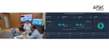
Joshi also reviewed the progress of the Digital India Land Records Modernisation Programme (DILRMP) and the Naksha pilot in a meeting with Anil Kumar, Chairman of the Revenue Board.
He stated that Uttar Pradesh has already made significant strides in digitising rural land records, with real-time khatauni, khasra and maps now available online. Each plot is being assigned a Unique Land Parcel Identification Number (ULPIN), which includes geo-coordinates, ownership details, and plot dimensions.
An online system is also in place to apply for succession, land transfer, certificates and corrections in records.
The revenue court management system allows litigants to access case details online and plans are underway to link land records with Aadhaar for enhanced transparency.
Under the Swamitva Yojana, drone-based surveys are being used to generate GIS-based rural maps, enabling villagers to leverage their land as a financial asset.



































Discussion about this post