


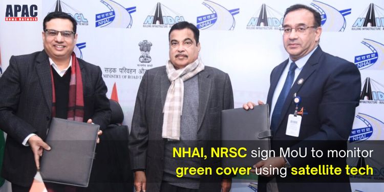
New Delhi: The National Highways Authority of India (NHAI) has inked a three-year MoU with the National Remote Sensing Centre (NRSC), a part of the Indian Space Research Organisation (ISRO). The collaboration aims to develop and report a “Green Cover Index” for India’s extensive National Highways network.
Since the inception of the Green Highways Policy in 2015, the Ministry of Road Transport and Highways (MoRTH) and NHAI have prioritised the greening of Highway Corridors. The existing method of monitoring plantations relies on site visits by field personnel.
To enhance in-situ data collection and improve plantation management and monitoring, the NRSC will leverage emerging technologies and high-resolution satellite imagery. The “Green Cover Index” will provide a comprehensive nationwide estimation of green cover along National Highways, offering a time-saving and cost-effective solution. This approach will also enable targeted interventions in regions with insufficient green cover.
Headquartered in Hyderabad, NRSC is mandated to establish ground stations, generate data products, and develop remote sensing techniques. Successful pilot projects for estimating green cover along National Highways have already been conducted as proof of concept.
The project aims to capture the Green Cover Index region-wise for National Highways in the initial assessment cycle. Subsequent cycles will focus on estimating the growth patterns of green cover using scientific techniques.
The results will facilitate comparison and ranking of various National Highways for timely and periodic intervention. With green cover estimated for every 1 km length of the National Highways, granular metrics for individual projects/packages can be generated.
Also Read More –
- NHAI to break ground on safety: Will undertake audit of 29 tunnels nationwide for seamless highways
- ISRO Invites Applications from Professionals and Students for Free Online Course on Remote Sensing


Discussion about this post